
Technologies for monitoring searches
September 22, 2026
During a field-training exercise or search simulation—in our case, involving search-and-rescue dog units—it is essential to know where team members are located and how they are moving. Displaying this information on a map makes it possible to coordinate activities more effectively, verify which areas have already been searched, and improve the safety of everyone involved. Today, several technologies are available, each offering different levels of cost, accuracy, and operational flexibility.
A Standard in Search Operations: Garmin Devices and Similar Systems.
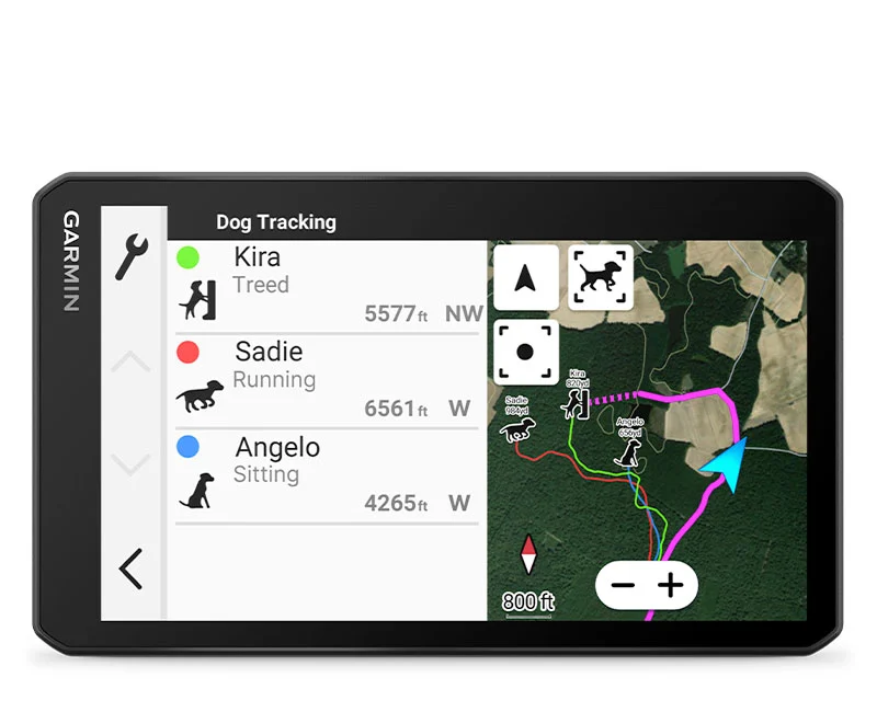
One option is to use Garmin devices designed for trekking, tracking, and search operations. These are reliable tools intended for field use. They can record positions, track routes, and, in some cases, communicate with radio collars or other devices.
When connected to a computer, these systems can also display the real-time positions of the various team members or search animals. However, they can be expensive, especially when several devices, collars, and related accessories are required.
Professional digital radio systems, such as TETRA or DMR, are another possible solution. These systems generally involve high equipment costs and often require expensive dedicated software.
LoRa and MeshCore Networks.
More affordable devices are also available and can be connected through an expandable LoRa or MeshCore network.
Their main limitation is positioning accuracy: locations cannot be determined with the same level of precision provided by professional systems. These devices typically use coordinates with only four decimal places 0.0001°. At latitude 45° north, this corresponds to an uncertainty of approximately 11 metres in the north–south direction and about 8 metres in the east-west direction.
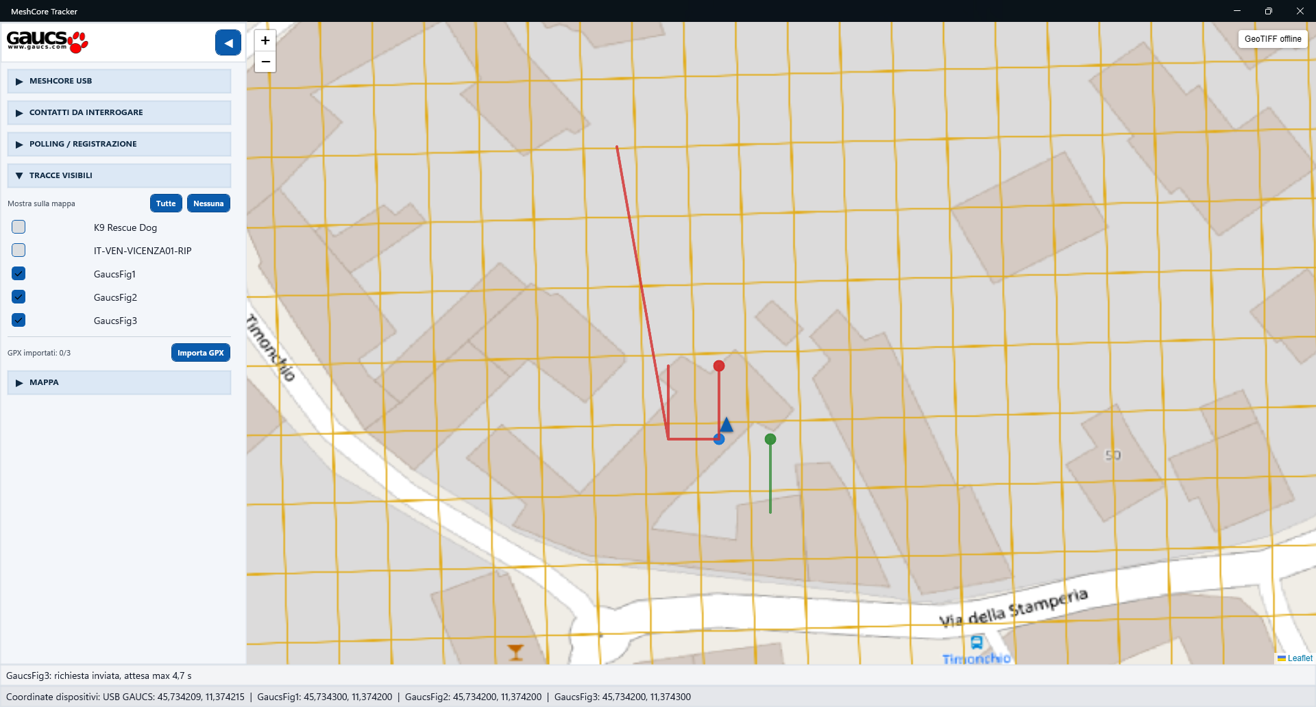
Another factor to consider is the radio frequency being used. Since this is a public frequency band, it may be occupied by other communications or users operating in different fields.
These devices are therefore not suitable for pinpointing a specific location with high precision. Nevertheless, they can provide useful information, such as whether a person is within a particular area, whether they have moved, or which areas have been approximately covered.
They can also be valuable during training exercises, allowing personnel in the field to be located when an emergency prevents direct communication or makes it difficult to determine their position.
Smartphone
A more accessible solution is to use the team members’ smartphones.
When cellular coverage is available, smartphones can transmit their positions in real time, allowing authorised participants to view movements on a map. If cellular coverage is unavailable, the phone can still record a GPS track offline.
The recorded track can be shared later, for example as a GPX file. This makes it possible to reconstruct the activity, compare the routes followed by different team members, and verify which areas have been searched.
Positioning accuracy and level of detail vary depending on the make and model of the phone. Devices supporting multiple GNSS constellations and dual-frequency positioning, such as L1 and L5, are recommended.
A Simple, Shared Visualisation
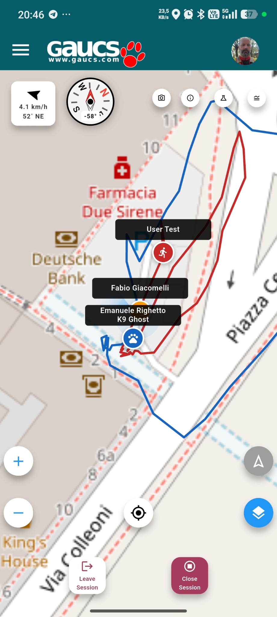
The image shows an example of a map displaying the positions and tracks of several people involved in a search simulation. Each team member is identified by a label, while their route is represented by a coloured line.
A visualisation of this type makes it possible to quickly determine:
- where team members are located;
- which routes they have followed;
- which areas have already been searched;
- whether two people are working in the same area;
- whether someone is moving away from their assigned area;
- how to coordinate subsequent activities more effectively;
- how to improve safety in the event of an emergency.
The goal is not merely to display points on a map, but to transform positioning data into a practical tool for supporting decisions during search operations.
Current Development Work
We are developing an application that allows smartphone positions to be displayed through both a mobile app and a web browser.
When cellular coverage is available, team members can be tracked in real time, and their positions can be shared with the search coordinator. This creates an immediate visual connection between the coordinator and the field teams, making it easier to change strategies when necessary. It also facilitates and accelerates the preparation of post-operation reports.
At the same time, we are testing a mesh network consisting of multiple devices. This type of network can allow devices to communicate directly with one another without relying on cellular infrastructure. The positions can then be displayed on a central computer or terminal, such as a tablet.
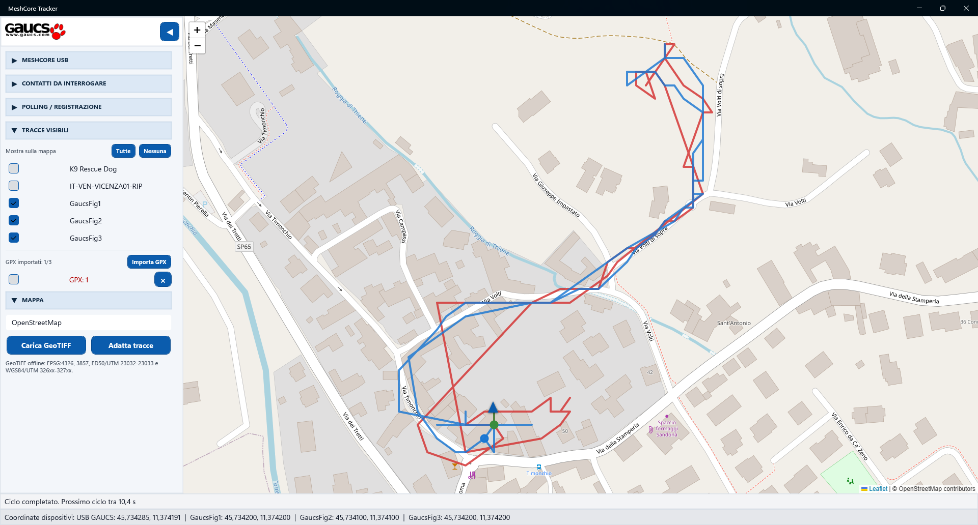
This approach could be particularly useful in isolated, wooded, or mountainous areas where mobile coverage is unavailable or unstable. Even when a smartphone cannot connect to the cellular network, the system may still provide useful information about the presence and movements of team members.
It is important to remember, however, that every technology has limitations regarding the precision and accuracy of the final data.
Final Considerations
No solution is perfect in every situation.
Professional systems offer greater accuracy and reliability, but they are expensive. Smartphones are widely available, but their positioning accuracy depends on the specific device, while real-time transmission depends on cellular coverage.
Low-cost devices and mesh networks can reduce reliance on existing infrastructure, but their accuracy and communication range must be carefully evaluated.
The most effective solution may therefore be an integrated system capable of using professional equipment, smartphones, and more affordable devices at the same time. This approach makes it possible to combine accuracy, accessibility, and operational continuity, providing search coordinators with a more complete overview of the entire operation.